Background
Upzoning, meaning an increase in permitted building density, is an effective tool for creating future-ready settlement structures. It helps meet housing demand, improve infrastructure provision, and at the same time reduce new land take. For the City of Salzburg’s new Spatial Development Concept, planners need robust, planning-relevant information in order to designate potential future upzoning areas in a targeted way.
Project Objectives
The goal was to develop planning-relevant data foundations to identify and assess potential upzoning areas, based on existing city planning data.
Results
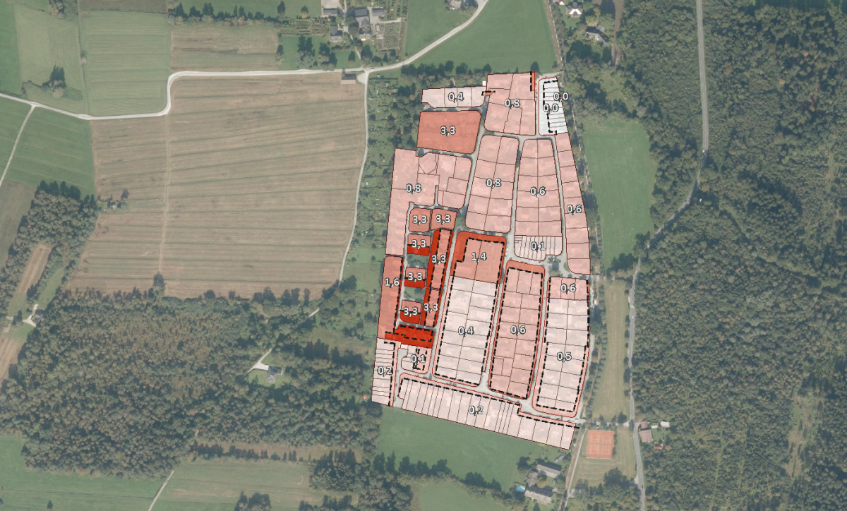
Using the developed method, a map service shows, at the level of individual zoning plan subareas, how much the average planned density in the analysis areas could be increased if only setback requirements and a selected maximum lot coverage had to be met. This allows an initial, purely computational assessment of areas where an increase in building density would have a greater development impact.